Our Changing Watershed: How Nature Works to Avoid Flooding in Muskoka
By Kevin Trimble.
We often don’t think about floods until we see torrents of water roaring over our dams and waterfalls, down our big rivers, or raising water levels in our lakes. But floods don’t start where we see them so where do they come from? In our last article Chris Cragg explained that if we have too much snow melting quickly, combined with a certain amount of rainfall at the wrong time, conditions are ripe for flooding.
In addition to weather, however, we need to know what a watershed is, its natural features, and our effect on them if we want to understand where floods start. A watershed is like a giant basin which captures rain, snow and groundwater and which is defined by a topographic high point around it. No matter where you’re standing right now, you are in a watershed. The Muskoka River Watershed is almost the size of Prince Edward Island, extending from Algonquin Park to the Georgian Bay shoreline.
Our big rivers and lakes can hold water for long periods of time, but they only occupy about 15 per cent of the Muskoka River Watershed. Forests and wetlands make up about 80 per cent of the watershed and they store and slow down water, reducing its flood potential. They also send up to 50 per cent of our annual rainfall back to the atmosphere through evapotranspiration.
A recent study managed by the District of Muskoka shows that, there are up to 14,000 ha of vernal pools in our watershed. These are small depressions that hold and use meltwater in the spring for short periods of time. Like wetlands, they reduce runoff. Many critical ecological processes occur in these vernal pools — they support amphibian spawning and important plant and invertebrate communities, without which our own well being would be compromised.
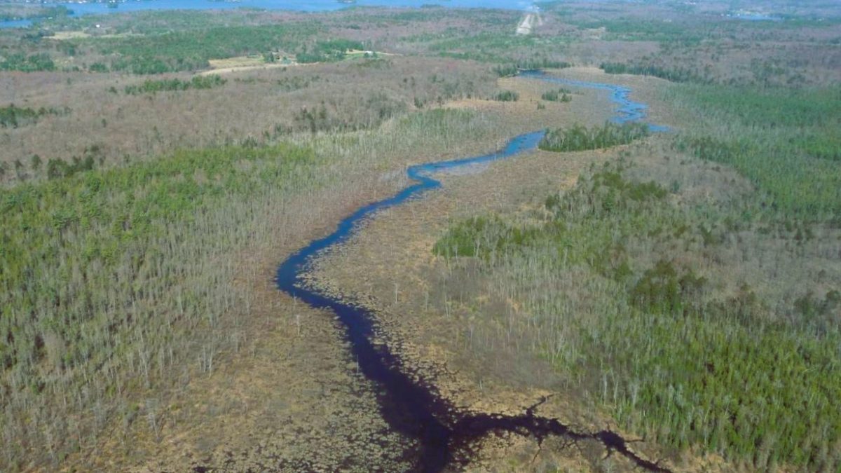
This same study identified up to 19,000 km of headwater tributaries that act like a capillary network — feeding the streams draining into our lakes and rivers. As melting snow and storm runoff drains from surface soils, rock features, wetlands and pools, it concentrates into rivulets that carve small channels. These channels come together and combine flows until they become more prevalent stream features. If this vast network was not present, water would flow from the landscape directly into larger systems much faster, leading to more flood and erosion risk. Like vernal pools, these features are also important for many ecological processes that we depend on.
Human activities also affect flooding. Climate change is causing erratic weather which may hasten snow melt or increase rainfall at critical periods. If our forests are not healthy there will be less evapotranspiration. When we remove a forest, wetland, vernal pool or small tributary, it is no longer available to hold water or pump it back to the atmosphere. And when we create hard pavements, fill in depressions on our property or harm wetlands, then runoff happens much faster than in natural systems. Some people may think that dams and infrastructure are the best way to prevent flooding. But the best prevention occurs at source — when we alter the landscape we need to consider where floods really start and consider how our activities may increase the risk of flooding in our watershed. This is a key feature of the Integrated Watershed Management approach promoted by the Muskoka Watershed Council.
This article is one of Muskoka Watershed Council’s summer 2023 series on “Our Changing Watershed” in The Muskokan newspaper. This week’s contributor is Kevin Trimble, a retired ecologist and Director of the Muskoka Watershed Council.