Our Changing Watershed: A Layman’s Guide to Spring Flooding in Muskoka
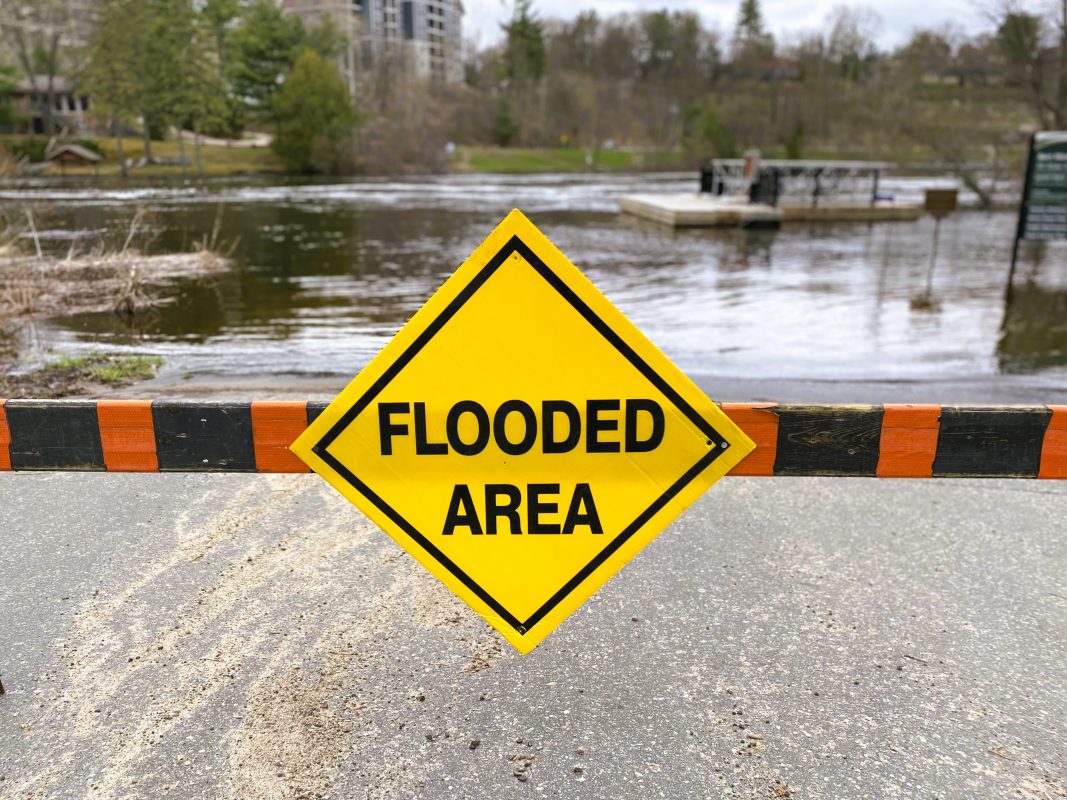
What happened in 2023?
By Chris Cragg.
The extreme spring flooding we saw in 2019 and 2013 does not happen every year. It only happens when a sequence of adverse factors combine in a short period of time.
When a heavy snowpack, rapid melting and subsequent heavy rain combine, the total amount of water released in the watershed exceeds the capacity of the lakes and rivers to contain it. When this happens, water spills over the shorelines and submerges roads, houses, docks and boathouses. Studying these past floods has helped identify these risk factors.
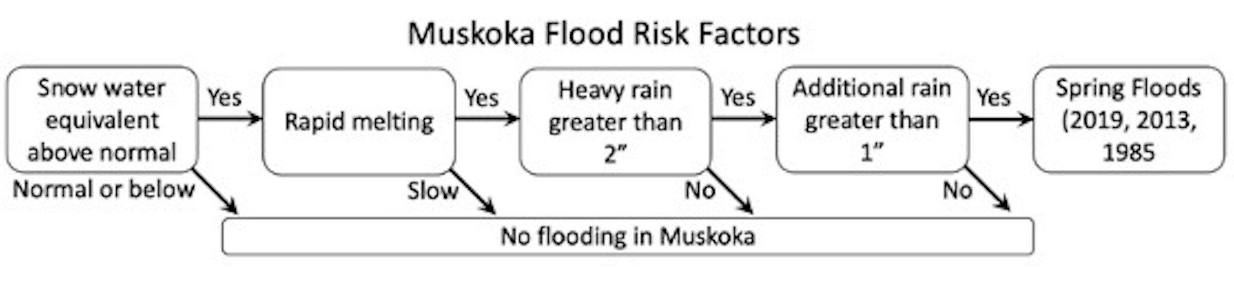
In sequence, if there is enough snow, if it melts quickly, if heavy rain falls during the melt period, and if further significant rain also falls before the watershed drains, then these components combine. If they result in 250 to 300 millimetres of water accumulation, then the watershed cannot contain this amount of water, nor can it release the water downstream due to physical constraints in the geography, and we get flooding. On the other hand, if any of these factors are not present, or do not occur in proximity in time, then flooding is avoided.
So, how much snow is a concern and how do we measure it? Typically, snow cores are taken at several locations around the watershed and the amount of water in the melted core is recorded. This measure is called “snow water equivalent.” Past flooding records have shown that flooding becomes possible when there is 150 millimetres or more of snow water.
Next, the snow has to melt rapidly to become a problem. Slow melting enables the meltwater to be accommodated by our rivers and streams so there is no problem. The Muskoka River Water Management Plan tells us that dangerous melting occurs when two or more days have peak temperatures exceeding 10 degrees Celsius.
Our next worry is heavy rain falling on the already melting snow. This both swells the volume of water and accelerates the speed of the melt. Past records show heavy rain as being more than 50 millimetres over a two-day period. When do we get heavy rain? Typically, Muskoka gets high rainfall when cross-continental storms, known as “Colorado Lows” or “Texas Lows,” transport “atmospheric rivers” of water from either the Pacific Ocean or the Gulf of Mexico. Environment Canada reports that the frequency and intensity of such storms is increasing due to climate change.
Lastly, subsequent significant rainfall of 25 millimetres or more can add to the water volume vying for space within watercourses and lakes of the watershed. If this occurs within a week of the previous melt and storm, then it adds to the water volume before the watershed has a chance to drain, exacerbating the situation.
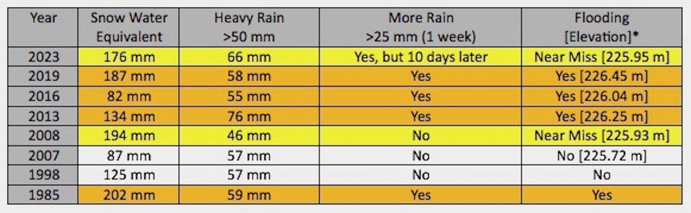
So what happened in 2023? For Lake Muskoka, the flood zone starts when water in the lake rises to an elevation of 225.97 metres. The table above shows, for Lake Muskoka in 2023, snow water near 2019 levels, heavier rain than 2019, melting temperatures in the 20-degrees-Celsius range and a “near-miss” flood event because the subsequent rain arrived more than one week later. Nevertheless, many shoreline properties built at lower levels were submerged. Fortunately, ice out occurred early, so there was no ice damage during high water.
These combined factors allow us to understand, identify and, in some cases, prepare for spring floods.
This article is one of Muskoka Watershed Council’s summer 2023 series on “Our Changing Watershed” in The Muskokan newspaper. This week’s contributor is Chris Cragg, water quality and environment chair for the Muskoka Lakes Association (MLA) and author of the MLA’s FloodWatch newsletter.