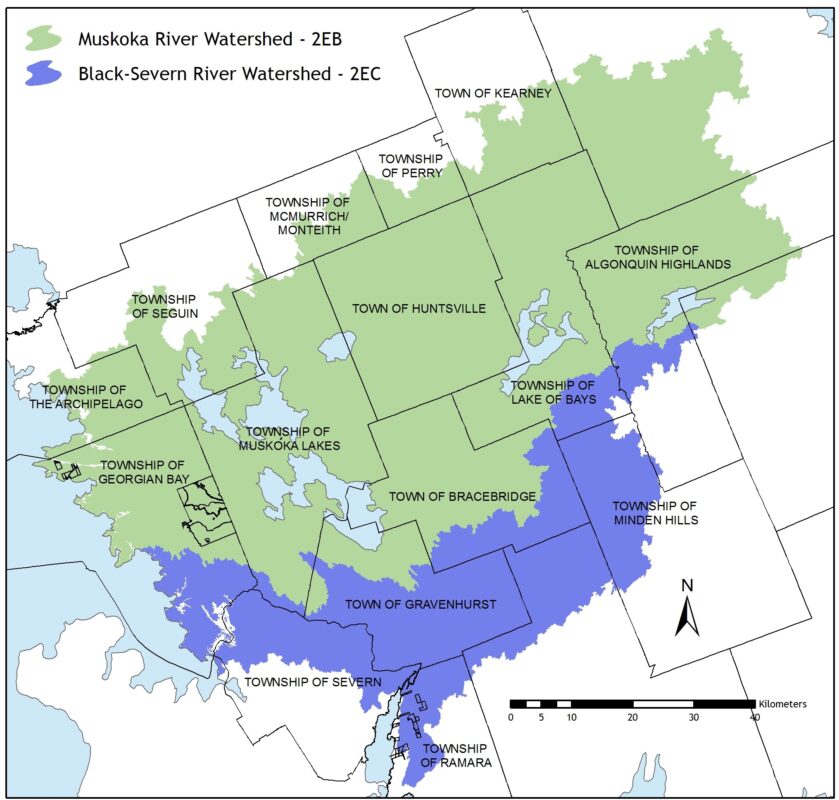
The Black-Severn River Watershed (2EC) encompasses an area from Newmarket in the south to Minden in the north and Honey Harbour in the west.
It includes all of Lake Simcoe in addition to the Black and Severn Rivers. The portion of the Black-Severn River Watershed that falls within MWC’s area of interest is limited to the northern portions of the watershed only and encompasses 2,538 square kilometres.
The headwaters of the Black River are in the Township of Algonquin Highlands. From there, the river flows in a south-westerly direction through the southern portion of the District of Muskoka and northern portions of the Township of Minden Hills, City of Kawartha Lakes, and Ramara Township to Lake Couchiching. From Lake Couchiching, it enters the Severn River and flows to Georgian Bay. Most of the land area in the Black River Watershed is Crown land, with the upper reaches being part of the old Leslie M. Frost Centre.
The portion of the Severn River Watershed that flows through the southern portion of Muskoka is the very bottom section of the Trent-Severn Waterway. The water flows from Lake Couchiching into the lower Severn River and out to Georgian Bay at lock 45 at Port Severn.
The portion of the Black-Severn River Watershed included in MWC’s area of interest is sparsely populated (less than 54,000 residents) with few large urban or agricultural areas. The land use tends to be a blend of rural residential and Crown land settings where population dramatically increases for the summer months as a result of a vibrant tourism industry and seasonal residents.